Saddleback Mountain Hike – Orange County Hiking Trail Overview:
Saddleback Mountain is the Grand Daddy among Orange County hiking trails! This incredible hiking trail ranks on the top of several hiking bucket lists! Yes, Saddleback is a big one to cross off the list and a premier accomplishment to add to your adventure folklore.
Although a milestone, Saddleback Mountain (the tallest in the Santa Ana Mountain range) is not for the faint of heart or inexperienced. This 18-mile round-trip adventure involves scaling up the 5,689 feet mountain (3,947 in gained hiking elevation). Before you think about attempting this hike, it’s best to make sure you are in good physical condition and have some hiking experience underneath your belt. If you are looking for a few good hikes to try before you scale up to Saddleback, the Go Hike It teams recommends Sitton Peak or Los Pinos Peak hikes.
As you plan for your hike, it’s important to bring enough water and food as there are no water stations along the Saddleback trail. It’s recommended to bring a large camel back that carries at least 3 liters of water (per person), lunch (for the summit), high-protein trail snacks (almonds, cashews, and other nuts), a few pieces of fruit, and even a soda (to help replenish lost salts & sugars) for the summit. For extra precaution, pack a first aid kit, sunscreen, cell phone, and bring a few extra bottles of water.
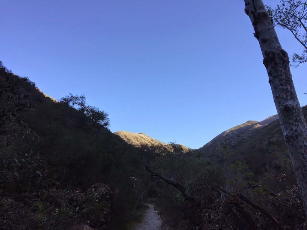
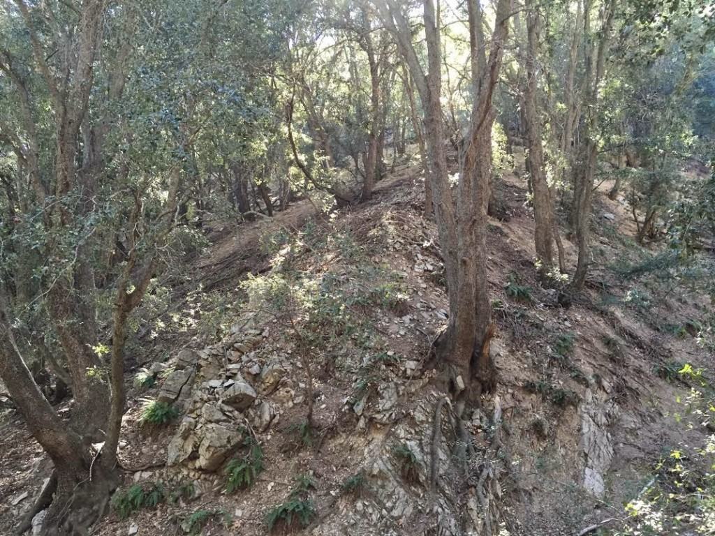
The first section of the Saddleback hike involves crisscrossing a river trail that leads to Holy Jim Falls. The Holy Jim trail is well marked and passes by a few older cabins. After crossing a bridge, the trail transcends up a canyon area.
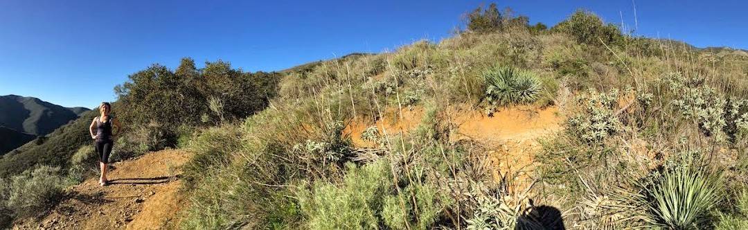
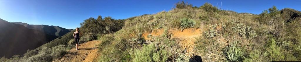
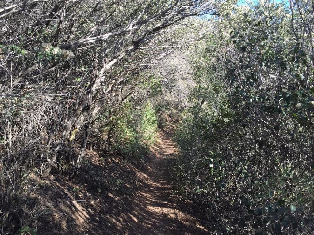
Shortly before the Holy Jim Falls, there is a turn off for a dirt trail. This turn will be on your left, which will start to take you up the hill. This switch-back trail is the second part of the hike and continues for 4-5 miles. Near the end of the switch back trail, the trail continues underneath dense tree overgrowth. This well-protected area provides good protection from the heat. Right after a moderate climb up a short hill, the trail intersects with the Main Divide Road.
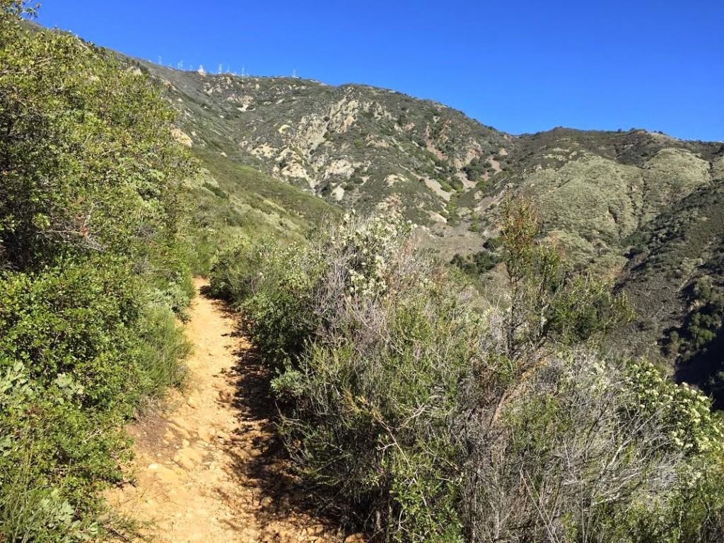
If you go left, the Main Divide Road will take you to the summit. This trail is rather wide and provides scenic, beautiful views of Orange County. If you make a right, you will intersect with the Upper Holy Jim trail (pay attention for the sign on the left hand side). This trail section features views of Ortega Canyon, Riverside County, and Lake Elsinore. The Go Hike It team went up Upper Holy Jim trail and returned down the Main Divide Road (which we strongly recommend).
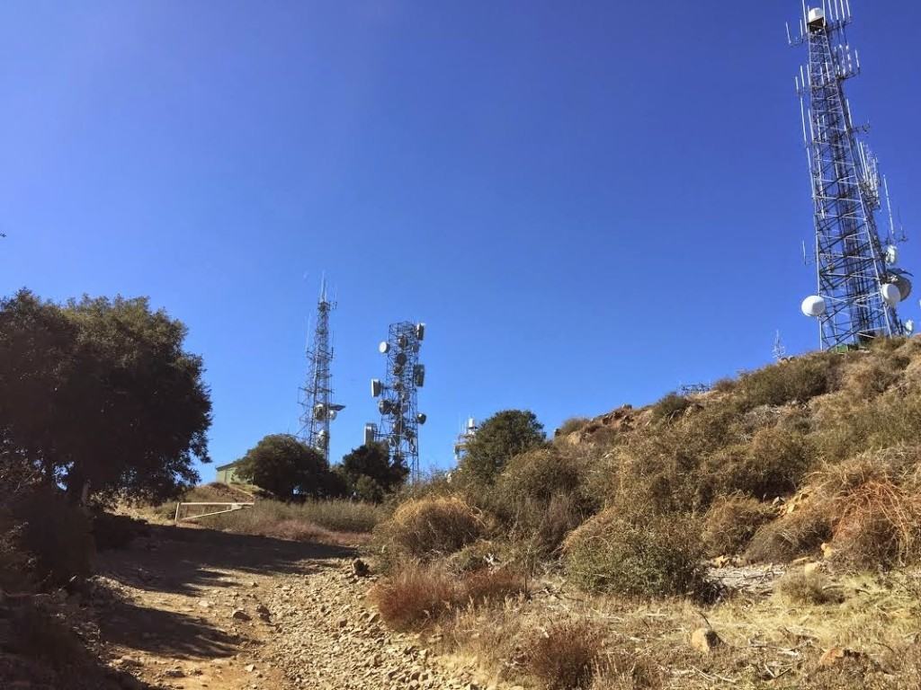
After you hike the third section, both options intersect with the Main Divide Road and continue up to the summit. This last section can seem long, as at this point you have been hiking for hours. However, with each turn, it brings around the hope of reaching the summit.
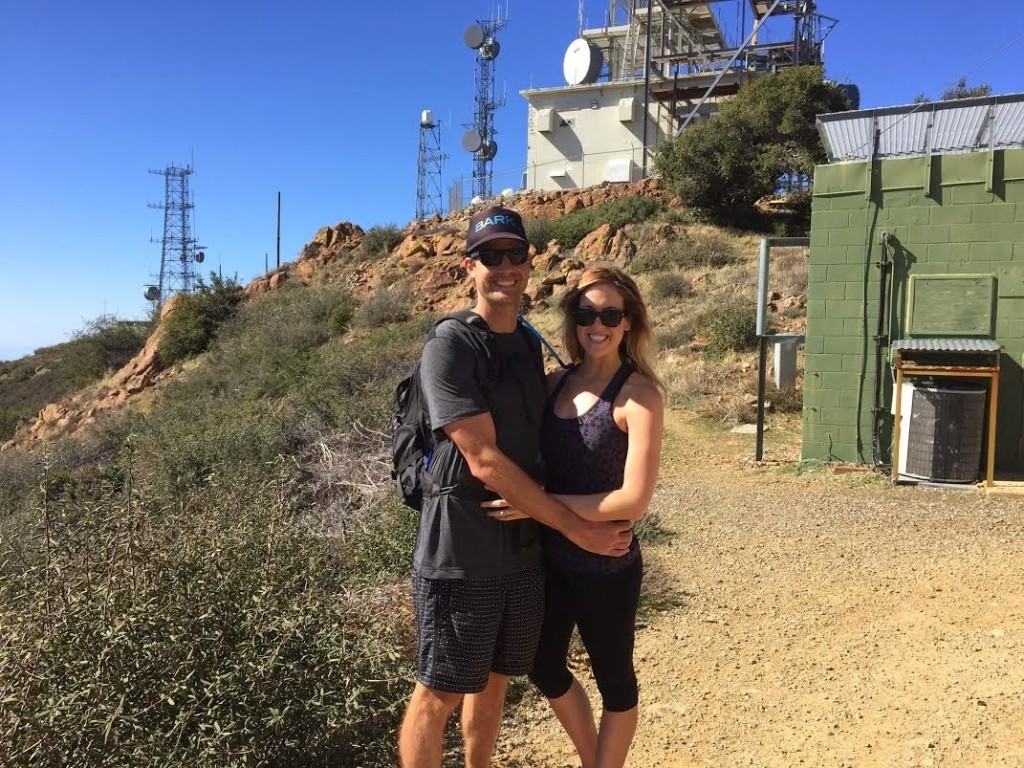
When do reach the summit, give your hiking partner a high five! You made it! Enjoy the beautiful views of the top and relish the moment!
Length: 18-19 miles miles round-trip

As Saddleback Mountain has been on the Go Hike It team’s bucket list for years, we were thrilled the reach the summit! The views up and down the hike were incredible and the feeling at the top was remarkable. After completing this hike, we have a strong feeling of accomplishment whenever we see Saddleback Mountain driving around in Orange County.
If you are up for an adventure and challenge, the Saddleback Mountain hiking trail is for you!
Saddleback Mountain Hiking Trail Map:
Directions to Saddleback Mountain Hike near Orange County (address for GPS):
- Take 1-5 South
- Take the exit onto CA-133N toward Santa Margarita (toll road)
- Take the exit onto CA-241 S Toward Santa Margarita (toll road)
- Take the Santa Margarita Parkway Exit (toll road)
- Turn right onto Santa Margarita Pkwy
- Turn left onto Plano Trabuco Rd
- Plano Trabuco Rd turns left and becomes Trabuco Canyon Rd
- Follow Trabuco Creek Rd to the Holy Jim Falls trail head.
- Take 1-5 North
- Take the Oso Pkwy exit
- Turn right onto Oso Pkwy
- Turn left onto Antonio Pkwy
- Turn right onto Alas De Paz
- Turn left onto Plano Trabuco Rd
- Plano Trabuco Rd turns left and becomes Trabuco Canyon Rd
- Follow Trabuco Creek Rd to the Holy Jim Falls trail head.
Where to Park:
- A parking area is located shortly after the volunteer fire station on Trabuco Creek Rd.
A Forest Adventure Pass is required for parking, because the parking area is located in the Cleveland National Forest. Day Passes are sold for $5 at various retailers.
What To Bring:
- 3-5 Liters of Water
- Camel Back Hydration Pack
- Sunscreen SPF 30
- Trail Snacks & Lunch
- First Aid Kit
- Small Flashlight
- Cell Phone
It’s important to start this hike early and give yourself at least 8-10 hours of daylight complete Saddleback Mountain. Although, you may finish it sooner, you don’t want to start this hike too late and run out of light. Additionally, it may be too hot during the summer or cold during the winter months to comfortably accomplish this hike.
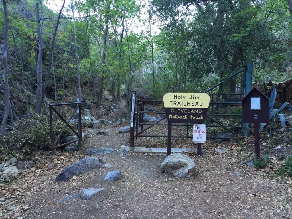 |
| Holy Jim Trail Head, the starting point Saddleback Mountain hike |
 |
| Early morning light at the start of the hike |
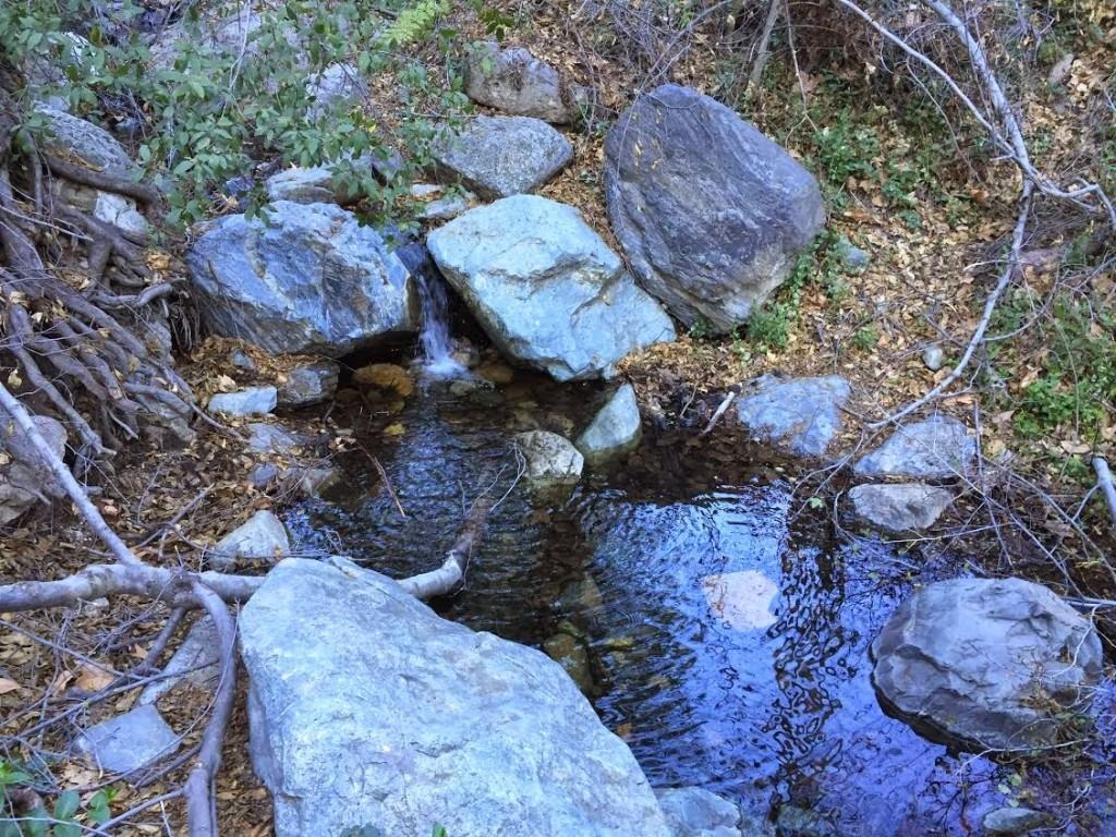 |
| Holy Jim Trail River |
 |
| Go Hike It Team crossing the Holy Jim Trail |
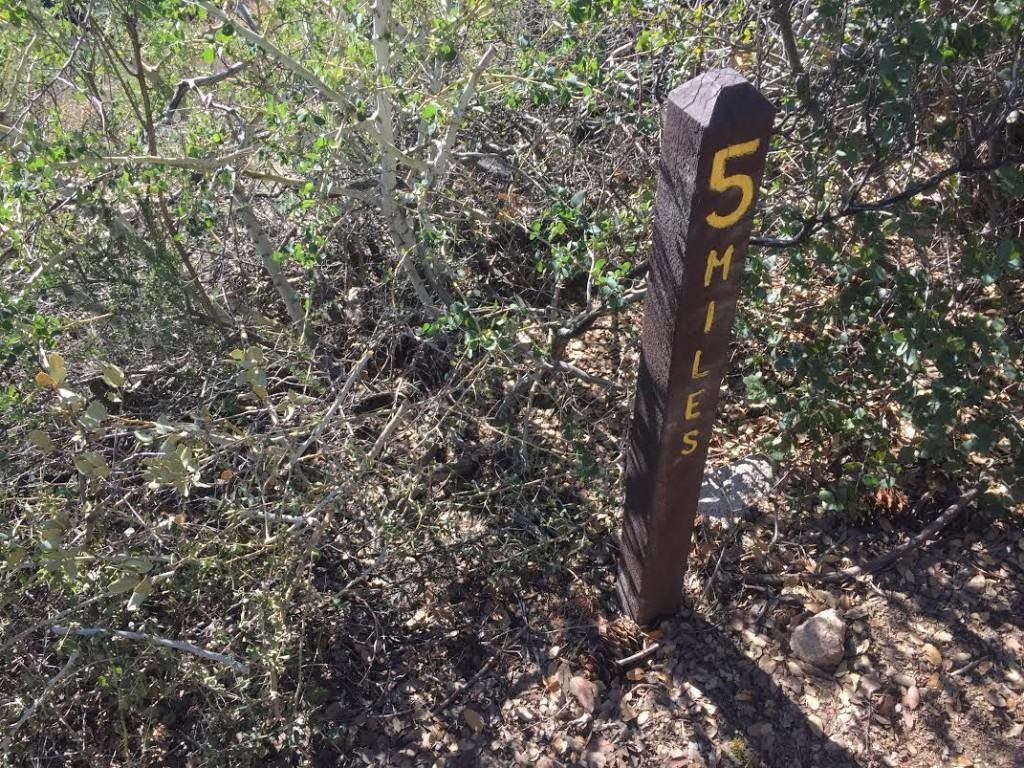 |
| Mile marker up the hill |
 |
| Criss-cross section up the Saddleback trail |
 |
| Dense overgrowth after trail switchback |
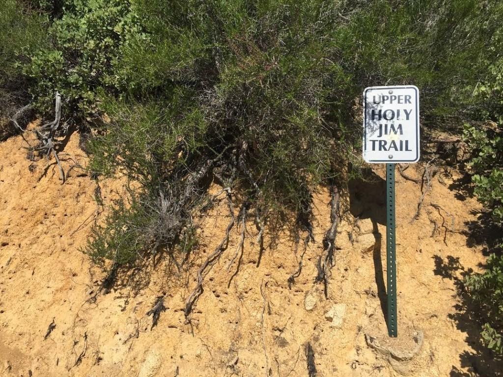 |
| Upper Holy Jim Trail sign |
 |
| Upper Holy Jim Trail looking down towards Orange County |
 |
| Top of Saddleback Mountain |
 |
| Go Hike It Team reaches the summit! |
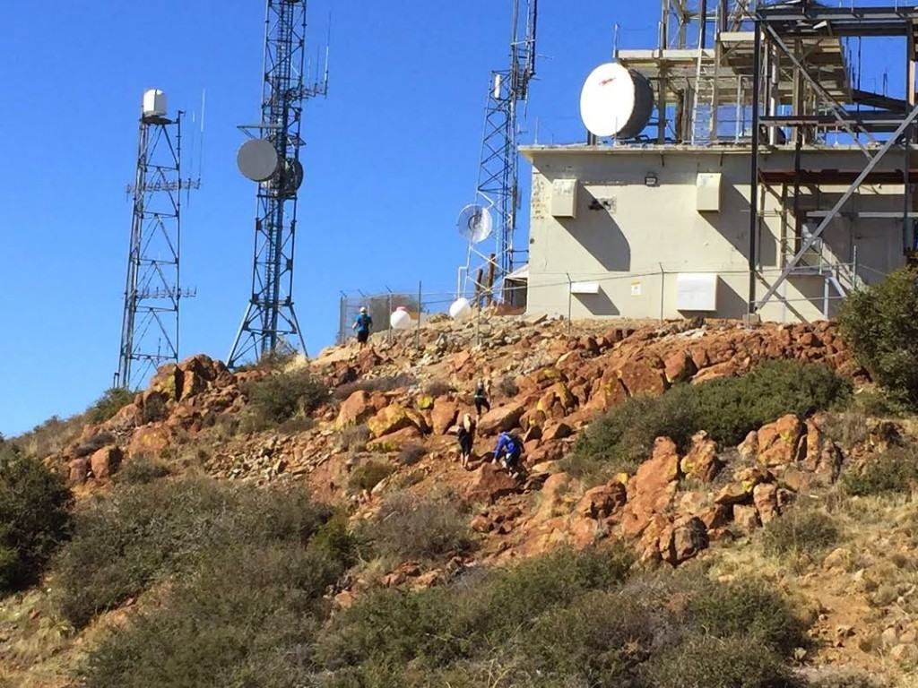 |
| Hikers climbing Saddleback mountain |
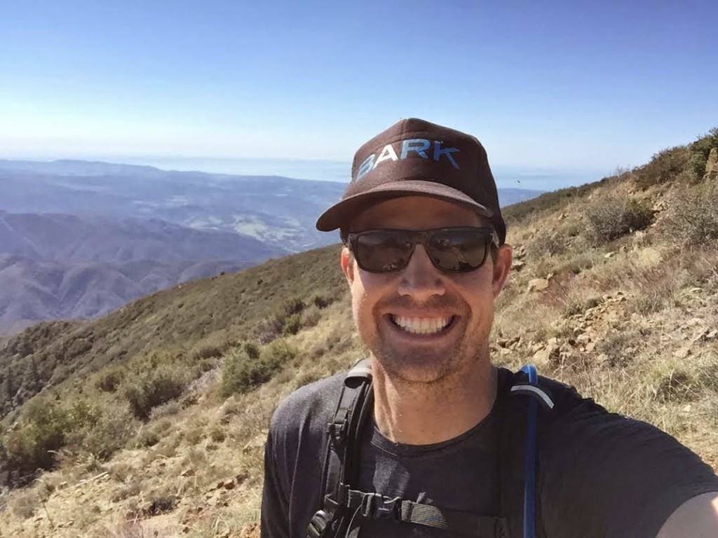 |
| Go Hike It Saddleback Summit Selfie! |
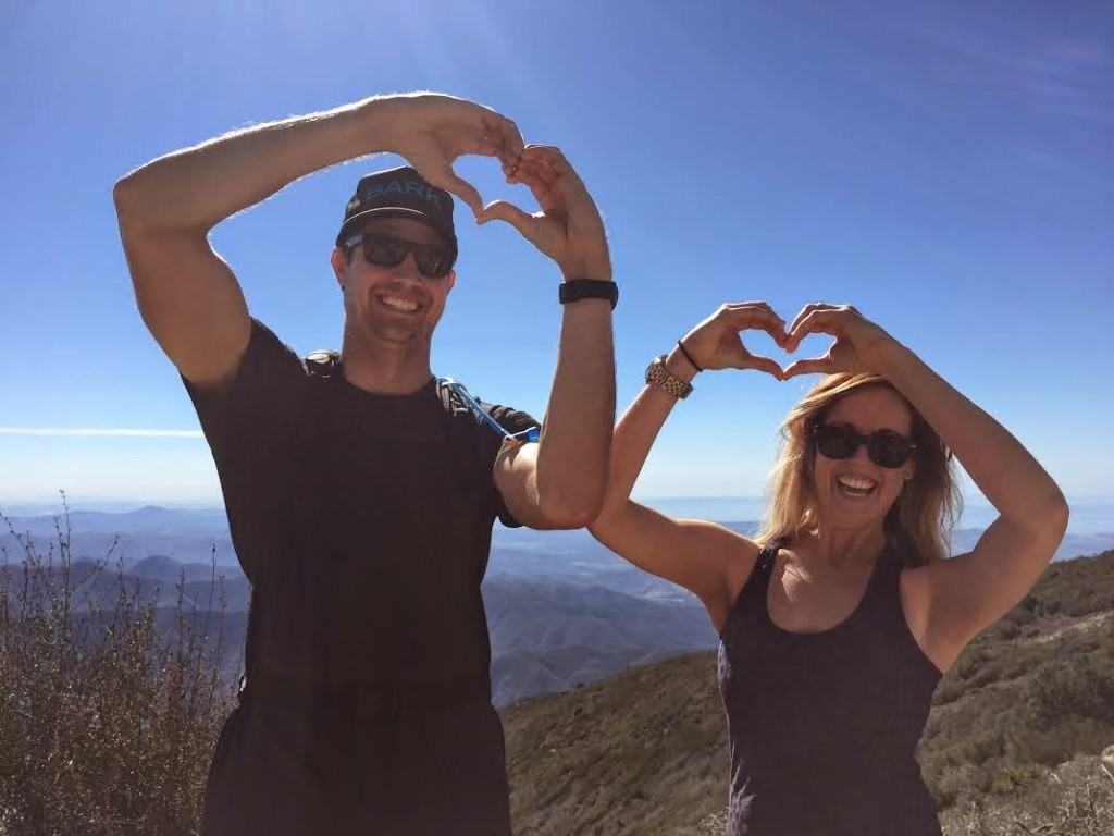 |
| Go Hike It Team sharing the hiking love! |
Intensity Levels:
- Barry-the-Bear: “I didn’t feel ready to try this hike. I’m currently preparing for this hike, by doing squats & lunges at the gym, and will try the Los Pinos Hike a few times before I attempt Saddleback Mountain.
- Larry-the-Lion: “Incredible! Although my legs were really sore for a few days after this hike, I felt such an accomplishment after it! We didn’t see too many hikers along the trail, so I’m happy that we were well prepared with water, snacks and sunscreen. The views at the top are incredible and worth seeing for any Southern California resident!”
- Chris-the-Cheetah: “I’m happy my car has high clearance! The drive out to the starting point was bumpy, but the trail was fun to cruise and enjoy. This was a challenge, even for the mightiest of any cheetahs. Although tough, if you have the will power, you will find your way to the top and enjoy the beautiful views!”
Have you hiked Saddleback? Leave a comment below and share your experience with The Go Hike It community!