
General Hike Overview:
Potato Chip Rock is located at the peak of Mount Woodson in Poway, California. Recently, the hike has become popular due hikers posting creative images on Facebook and Instagram. The hike is approximately 8 miles roundtrip, and during the summer months, it is recommended to start early in the morning due to Poway’s hot desert climate.
The first half of the trail is pretty much an uphill climb, where you’ll find the Potato Chip Rock at the very top. Don’t be surprised if you find a line of people waiting to take their picture on this popular rock! Then, you’ll descend the same trail on your way down. Obviously, you’ll find that going down is a lot faster than going up the trail.
Once you get to the top of the mountain, Potato Chip Rock offers an unforgettable background to take pictures. It looks like you’re on the ledge of a cliff (which you basically are). The views and scenery from the top of the mountain are epic! Definitely bring your camera. Also, the uphill climb is challenging for even experienced hikers, so bring plenty of water.

Once you get to the top of the mountain, Potato Chip Rock offers an unforgettable background to take pictures. It looks like you’re on the ledge of a cliff (which you basically are). The views and scenery from the top of the mountain are epic! Definitely bring your camera. Also, the uphill climb is challenging for even experienced hikers, so bring plenty of water.
Trail Map:
Directions:
From the North/Orange County Area
- Take the I-5 S toward San Diego.
- Merge onto CA-78 E via EXIT 51B toward Escondido/Vista Way. – 16.4 mi
- Merge onto I-15 S toward San Diego. – 5.7 mi
- Take the Pomerado Rd exit, EXIT 26, toward Highland Valley Rd. – 0.2 mi
- Turn slight right onto Pomerado Rd/W Bernardo Dr. Continue to follow Pomerado Rd. – 2.9 mi
- Turn left onto Rancho Bernardo Rd. – 0.4 mi (Rancho Bernardo Rd is 0.1 miles past Caminito de la Gallarda. SHELL is on the corner. If you are on Pomerado Rd and reach Rios Rd you’ve gone about 0.2 miles too far.)
- Rancho Bernardo Rd becomes Espola Rd. – 2.4 mi
- Turn left onto Lake Poway Rd. – 0.5 mi
- Lake Poway Rd is 0.1 miles past Morning Air Rd. (If you reach Trailwind Rd you’ve gone about 0.1 miles too far)
- 14644 LAKE POWAY RD is on the left. (if you reach the end of Lake Poway Rd you’ve gone about 0.2 miles too far)
From the South/San Diego Area
- Merge onto CA-163 N via EXIT 16 toward Escondido.
- Merge onto I-15 N via the exit on the left. – 7.3 mi
- Take the Ted Williams Pkwy exit, EXIT 19, toward CA-56 W. – 0.6 mi
- Turn right onto Ted Williams Pkwy. – 2.5 mi (if you reach I-15 N you’ve gone about 0.3 miles too far)
- Turn right onto Twin Peaks Rd. – 2.3 mi (Twin Peaks Rd is 0.2 miles past Pomerado Rd. If you are on Deerwood St and reach Peachwood Ct you’ve gone a little too far)
- Turn left onto Espola Rd. – 2.1 mi (Espola Rd is 0.1 miles past Roberto Rio Rd. If you reach Kalapana St you’ve gone about 0.1 miles too far)
- Turn right onto Lake Poway Rd. – 0.5 mi (Lake Poway Rd is 0.1 miles past Trailwind Rd. If you reach Morning Air Rd you’ve gone about 0.1 miles too far)
- 14644 LAKE POWAY RD is on the left. (If you reach the end of Lake Poway Rd you’ve gone about 0.2 miles too far)
Where to Park:
- Bring $10-15 cash to purchase a Lake Poway day parking pass. The parking lot is adjacent to the park. Start the hike at the Mt Woodson Trail-head. When driving into the parking lot, continue to the very right of the lot. If you need assistance, ask the Park Ranger.
What to Bring:
- 50-75 oz. of water
- Camelbak 50 oz Hydration Pack
- Sunscreen SPF 30
- Lunch
- Trail snacks
- First Aid Kit
- Cell phone
When to Go:
- Fall/Winter/Spring during cool days. Try and avoid the summer months as it can reach over 100+ degrees Fahrenheit during peak hours.
- Due to Poway’s warm climate, it is recommended to start the hike early in the morning. Allow for 3-4 hours to complete. Since the Potato Chip rock is a popular photo location, going early will help avoid the crowds at the summit.
How the Trail Looks:
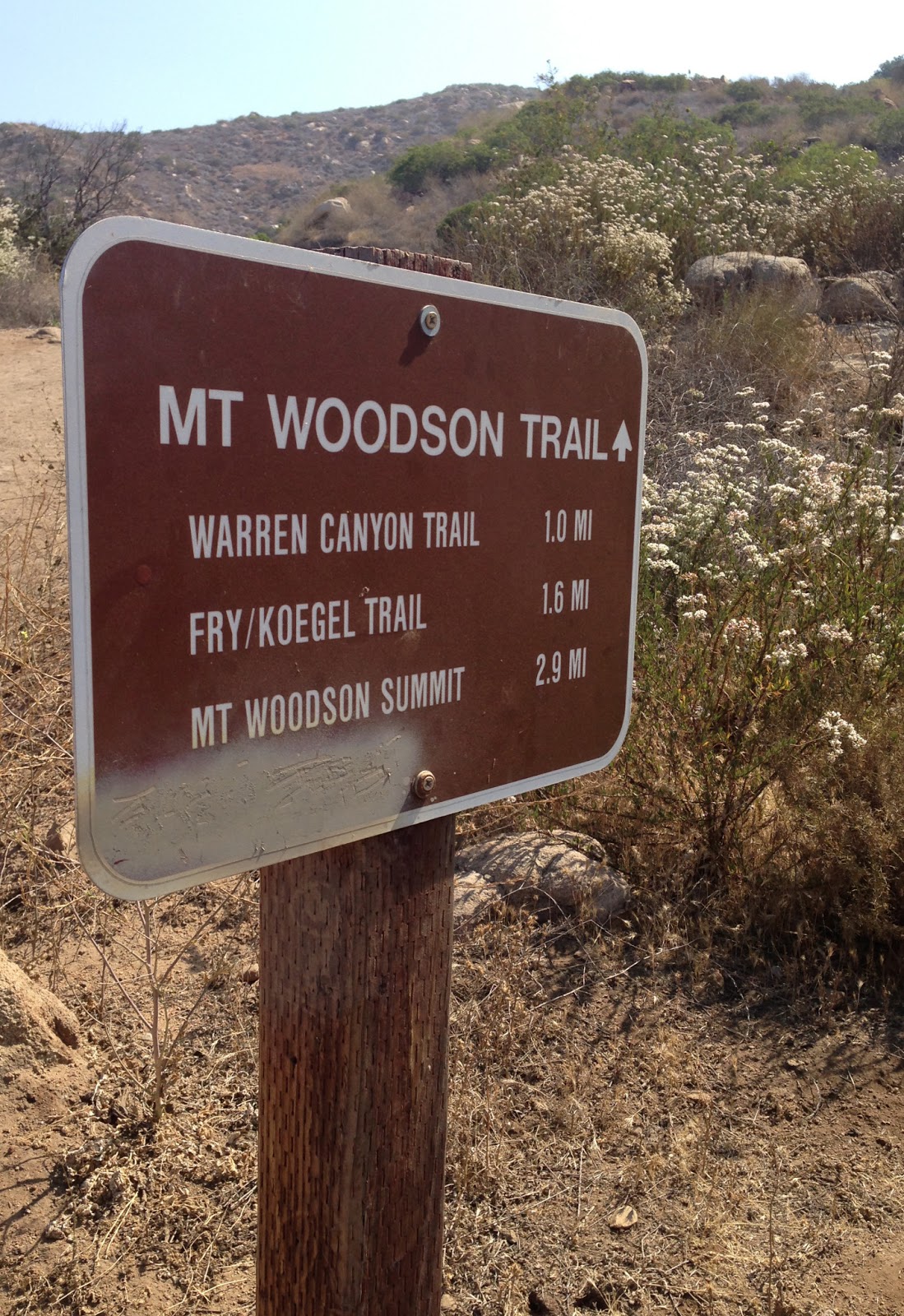 |
| Follow the Mt. Wood Trail to Mt Woodson Summit |
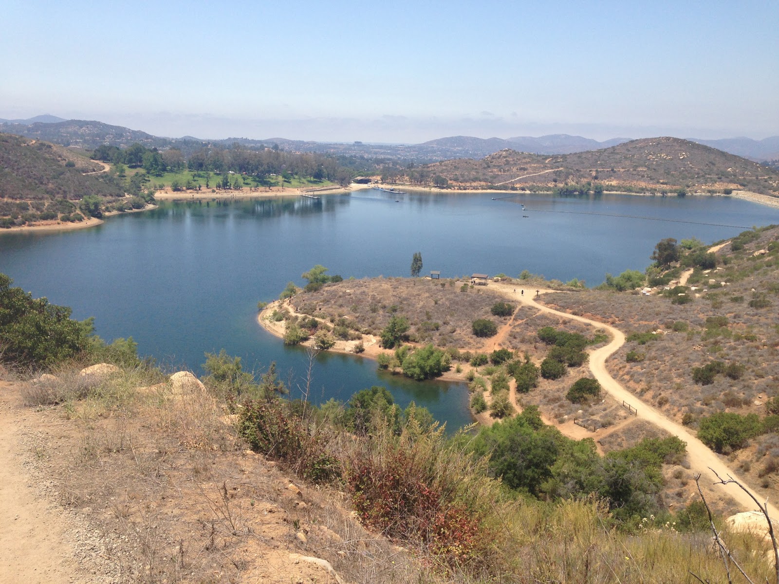 |
| Lake Poway |
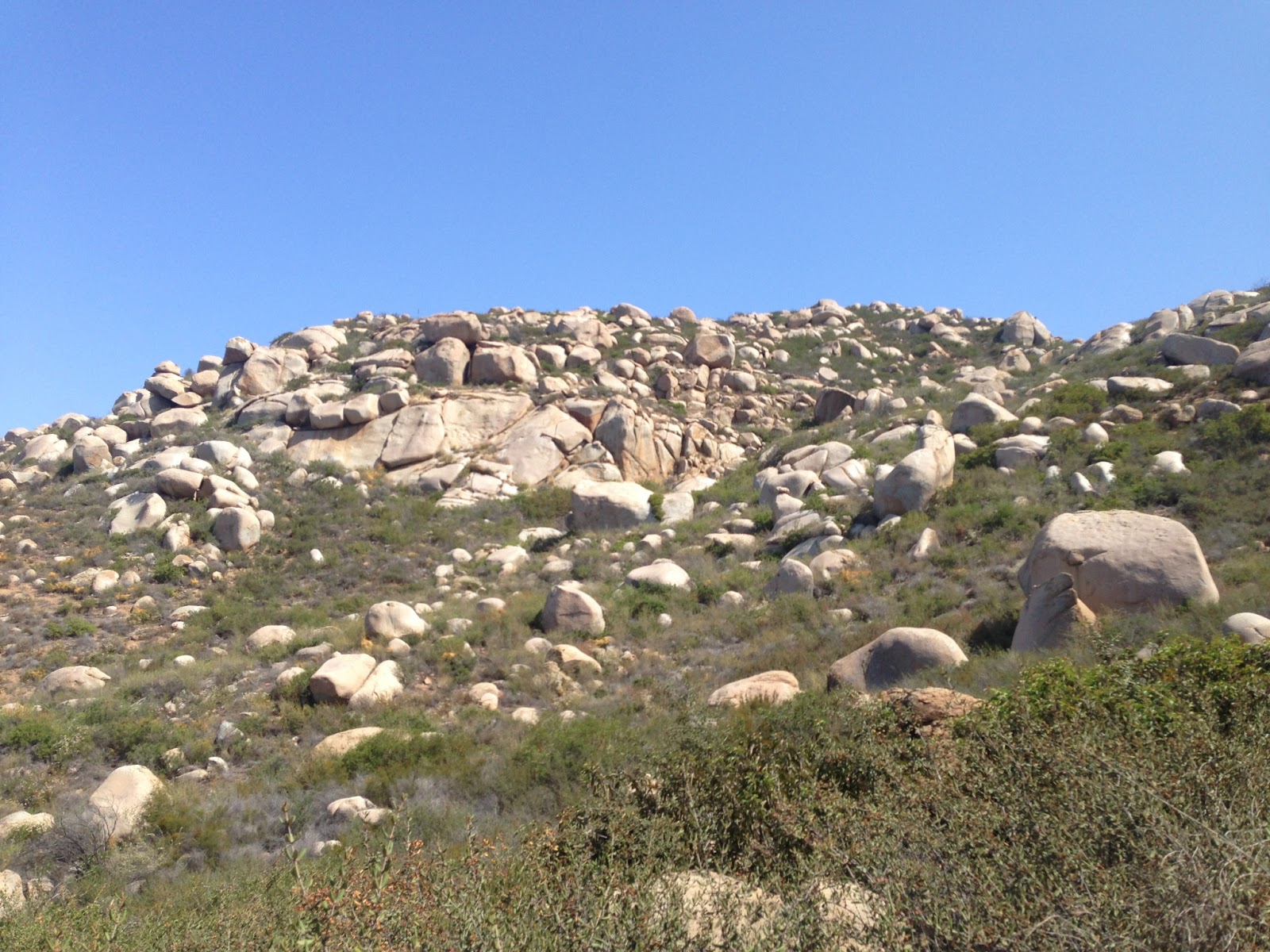 |
| Boulders as seen on the hike to summit |
 |
| Hiking up to Mt. Woodson Summit |
 |
| Don’t fall! |
 |
| A Lion King Moment |
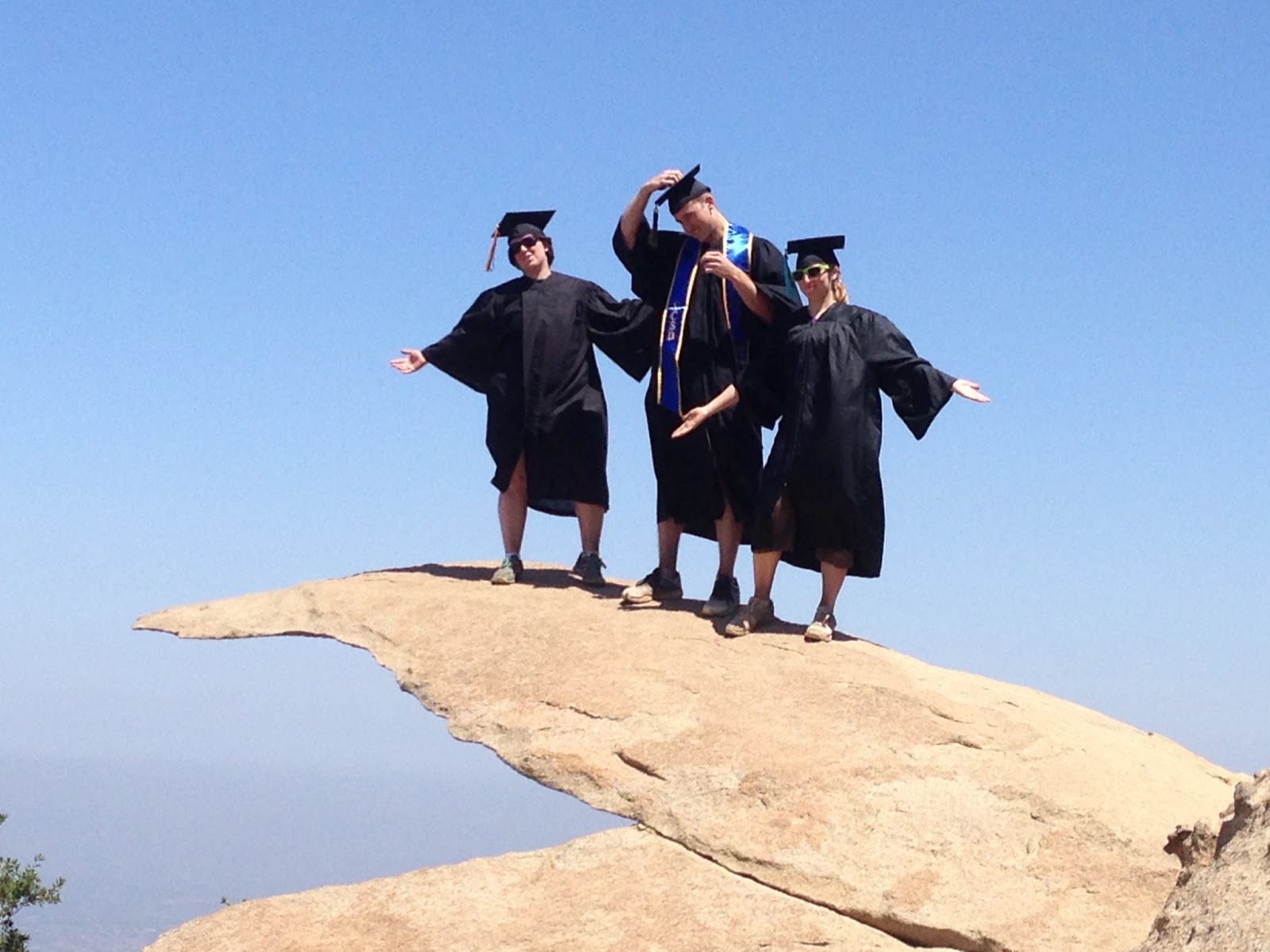 |
| Recent Graduates |
Dog-Friendly:
- Yes, on leashes. It is highly recommended to bring water and dog treats, as the hike to the top is grueling on dogs. It also helps to walk in front of a large group as the trail is very dusty and can affect the dog’s vision.
- Barry-the-Bear: “Wow! This hike kicked my Barry Air! I finished the hike three days ago and I’m still sore. I can’t believe how grueling the climb up the mountain was on my body. It took my over 5 hours to complete, including a rest at the summit. I’m glad that Stone Brewery was only 20 minutes away. It made for great place to grab a bear, I mean beer afterwards.”
- Larry-the-Lion: “That hike was a blast. My group really loved the hike’s scenery including the panorama views of Lake Poway and views from the top. We were a little nervous to walk on top of Potato Chip Rock, but it was well worth the picture. I’m glad my friend asked someone in line to take our picture who informed us to use hashtag #potatochiprock when we posted the images on Instagram. The hike took us 3.5 hours to complete, including a lunch rest at the top.”
- Chris-the-Cheetah: “Finally a challenge! I thought the hikers at GoHikeIt.com only posted easy hikes. I love to challenge myself and I found the climb up the hill was long enough for a good workout. The hike took me about 2:15-2:30 to complete, excluding the time I spent waiting to take my picture on that popular Potato Chip Rock!”
Have you tried the Potato Chip Rock Hike Trail? Share your experience with a comment below!