Sedona Airport Mesa Hiking Trail
Sedona Vortex Hike
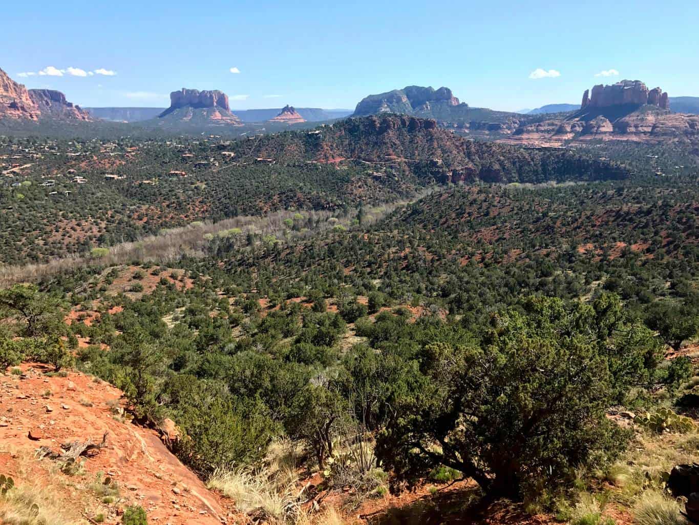
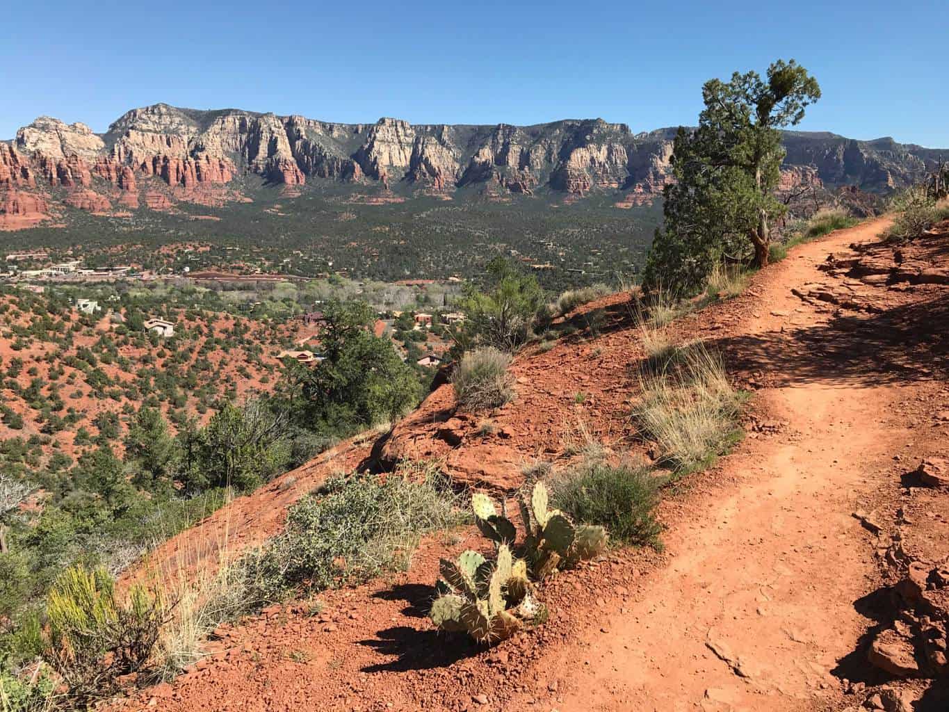
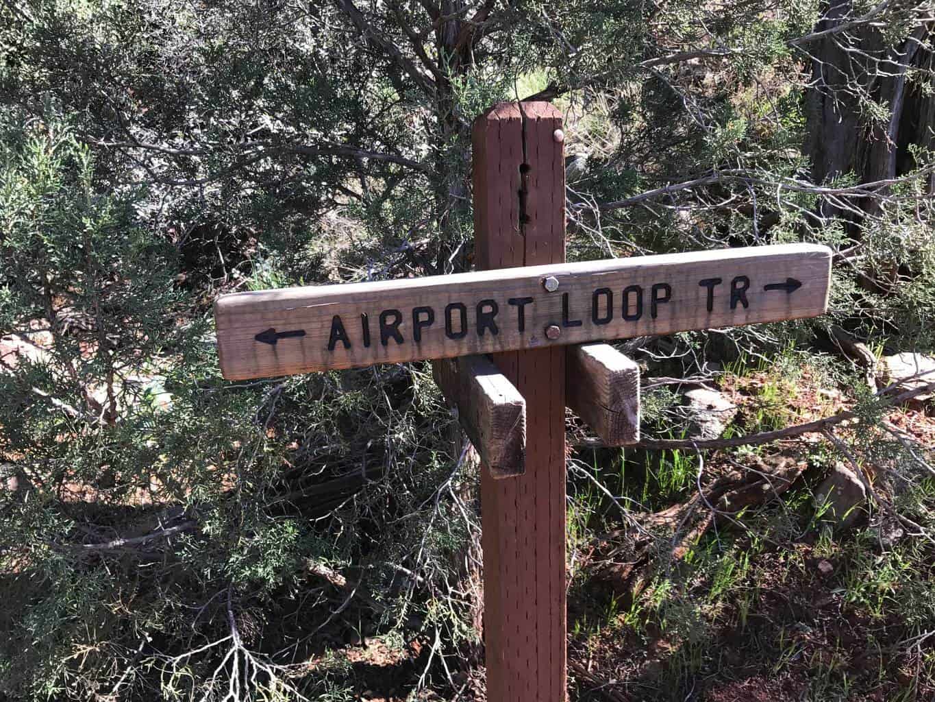
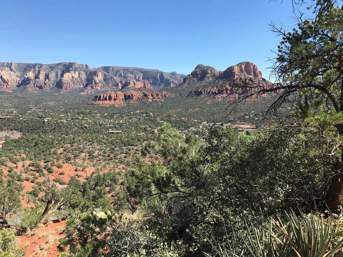
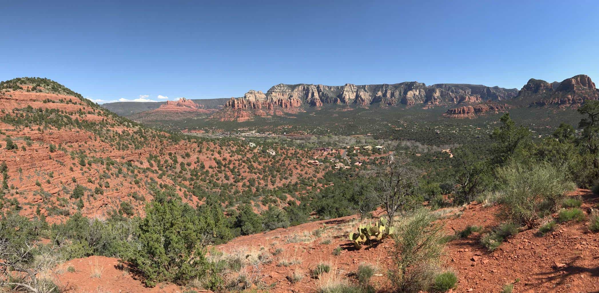
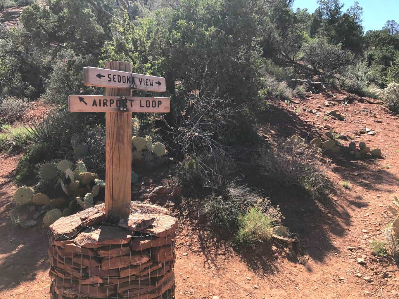
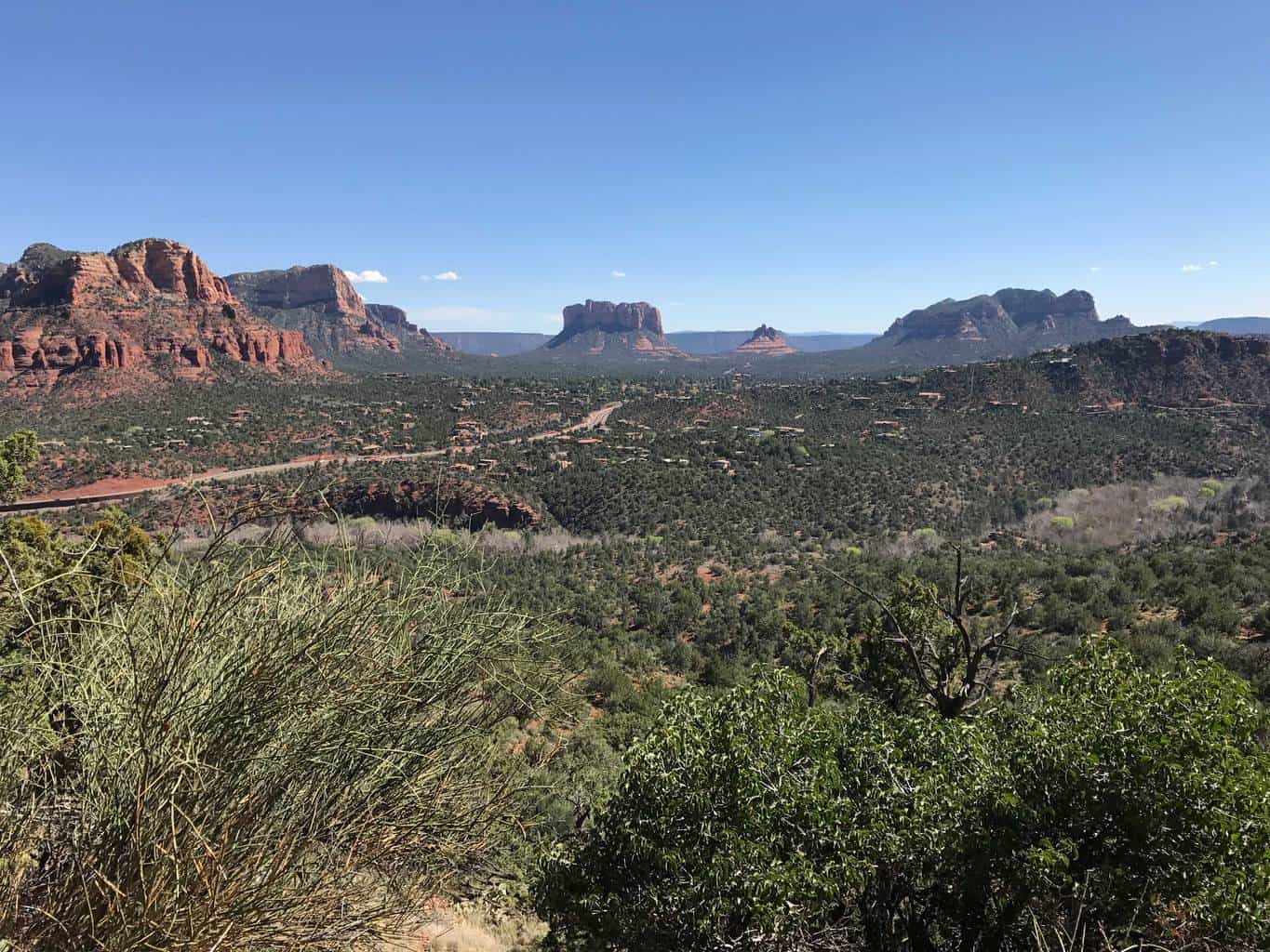
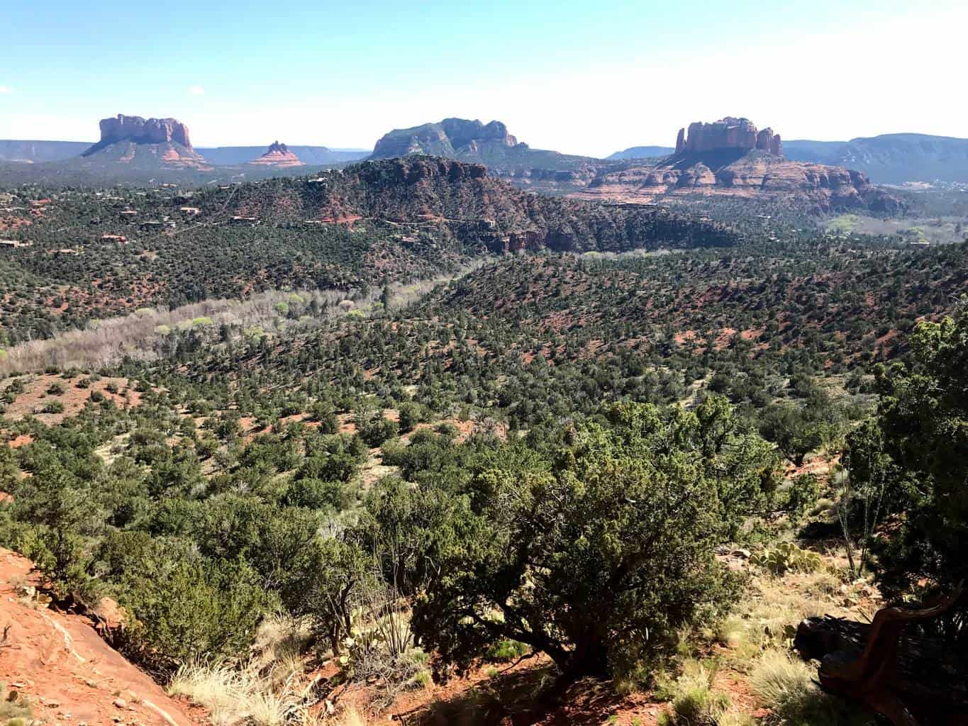
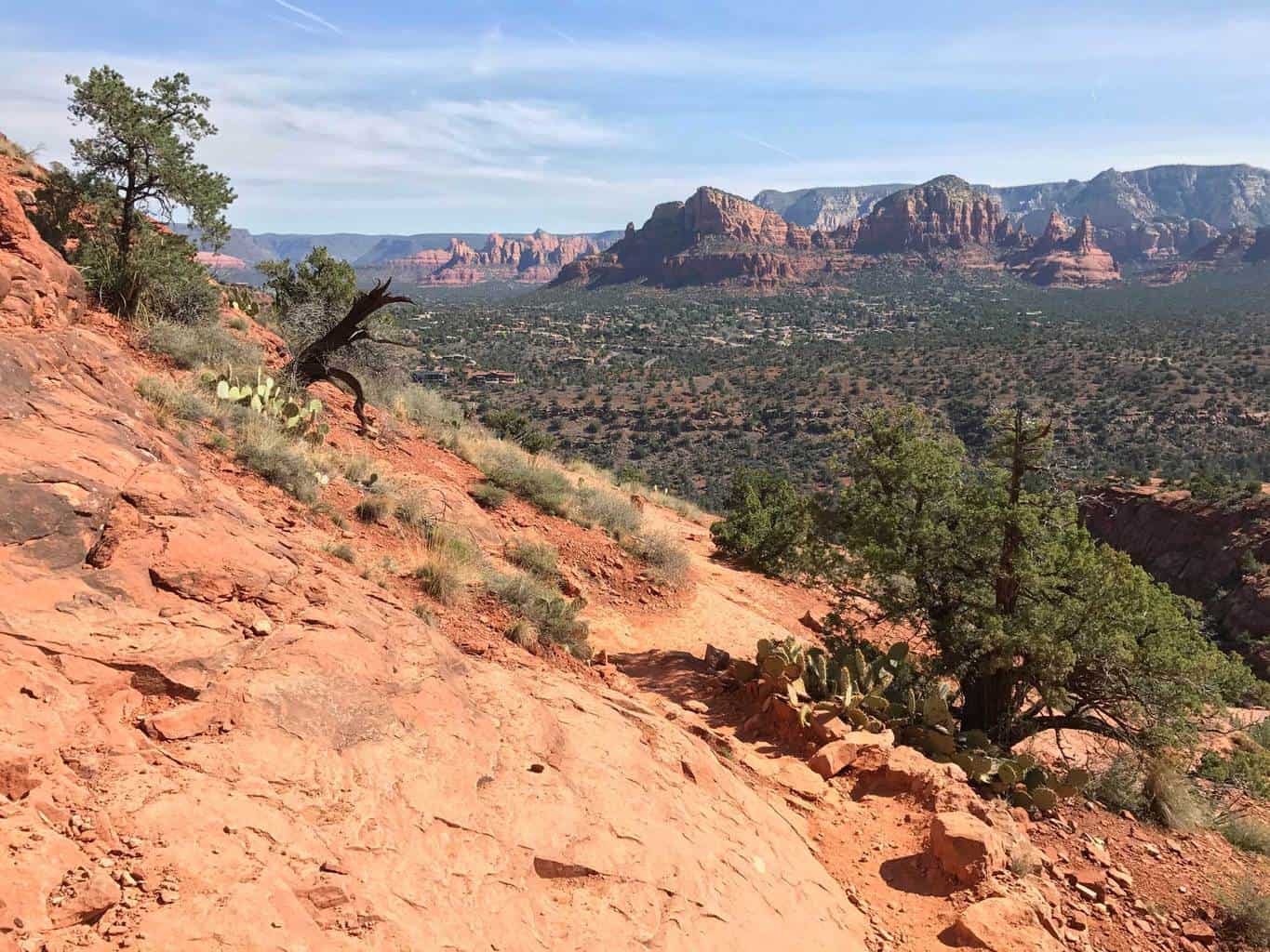
Best Sedona Hiking Trails | Airport Mesa Vortex Hike: Located on a hilltop overlooking beautiful downtown Sedona, the Airport Mesa Trail offer hikers incredible views of red rock country. The 3.5 mile loop starts near one of Sedona’s vortex sites, which offers an area to recharge & ponder the area’s bountiful inspiring sites. Continuing past the vortex site, hikers can enjoy panoramic views of the area’s iconic rocks, including Cathedral Rock, Cockscomb & Chimney Rock, Capitol Butte & Coffeepot Rock.
The trail loop is relatively flat with only a 200 foot increase in elevation during the 3.5 mile hike. Although relatively a short hike, it’s recommended to wear good hiking shoes as the trail surface can be unstable in certain areas and to bring plenty of water.
If you’re searching for a fun introductory hike to Sedona or a way to see a vast majority of the famous red rocks, this trail is for you!
Estimated Time: 2 hours
Total Distance: 3.5 miles (round-trip)
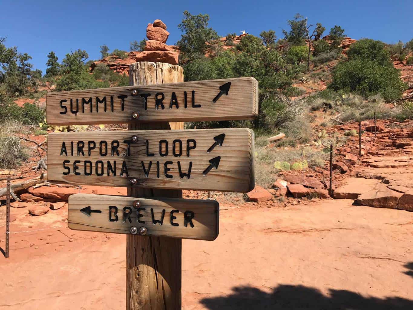
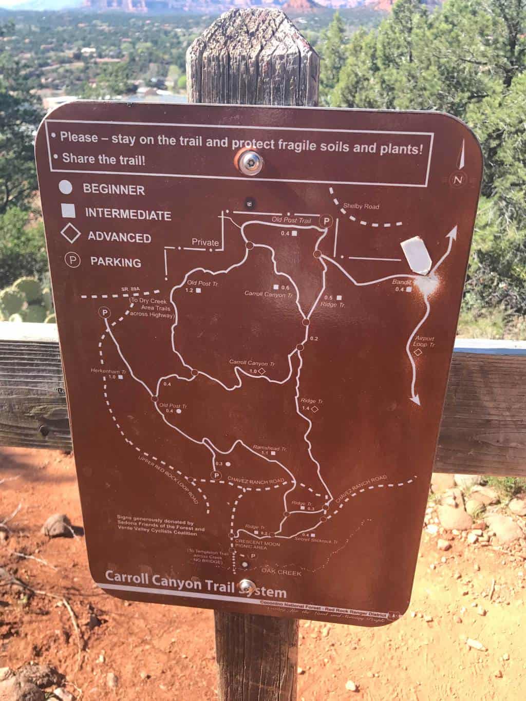
Map & Directions
Trail Pictures
Total Distance (miles)
A vortex is an unusual rock formation, where people report feeling inspired or having a lot of energy.
Total Estimated Time (hour)
The Airport Mesa Vortex trail stands at 4,500 feet elevation.
Airport Mesa Hiking Trail Photo Gallery
(click on image to rotate through image/s)


When to Go
Fall/Spring: The best time to enjoy the Airport Mesa Trail loop is during fall or spring, when the temperatures are generally milder. During the winter months, the trail can be very icy and during the summer months temperatures can be very hot.
Dog Friendly
Yes,, dogs on leashes are allowed on Sedona’s Airport Mesa hiking trail.
Airport Mesa Hiking Trail Map
Airport Mesa Vortex Trail Directions
Address for GPS: 483 Airport Rd, Sedona AZ 86336
Why We Liked It
Let the Vortex inspire you! The Airport Mesa Hiking Trail is a perfect compliment to any Sedona trip. We enjoyed seeing the famous sites of local landmarks, including the Courthouse Butte rock. Although the first section of the hike is very popular as other outdoor enthusiasts venture to the vortex, the remaining parts of the trail were relatively uncrowded.
If you’re planning a trip to Sedona, we definitely recommend adding this hike to your bucket list!
Discover a New Trail
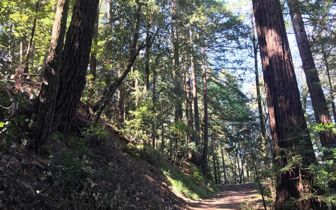
Santa Cruz Redwoods Hiking Trail | Rincon Fire Road Trail
Rincon Fire Road Trail is a moderately trafficked 3.9 mile out and back hiking trail in the middle of the Santa Cruz redwoods. This trail is popular with hikers, mountain bikers and even horseback riders. If you’re searching for a family friendly hike underneath redwoods, this is it!
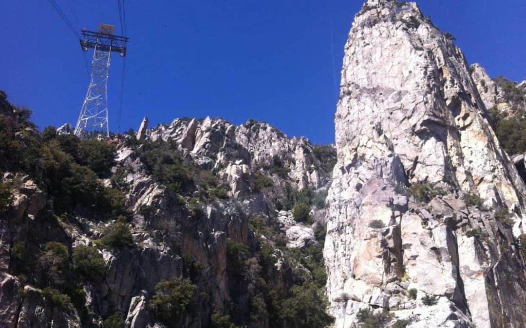
Palm Springs Aerial Tramway Hike To Mt San Jacinto
The Palm Springs Aerial Tramway Hike is a beautiful Palm Springs. See trail maps, pictures and learn why this desert hike is a fun way to stay cool.

Best Los Angeles Hiking Trail | LA Hikes
Discover the best hikes in Los Angeles, including Griffith Park, Franklin Canyon, Malibu and more! Learn why LA has some of the best hikes in California and see the area’s trail maps, pictures and hiking reviews.