
Laguna Niguel Hike – Salt Creek Hiking Trail Overview
Salt Creek Beach is part of the Salt Creek State Beach Park, which features 7 acres of grass hills, beach volleyball, a seasonal snack bar, and beach volleyball courts. The beach has a legondary surf break that his home to several professional and amature contests throughout the year.
Salt Creek is located a stone’s throw from the Ritz Cartlon of Laguna Niguel. Although the beach is now technically in Dana Point, the hiking trail starts in Laguna Niguel and reaches the beaches of Dana Point. If you are searching for a fun way to hit the beach during the summer months and also get a work out in, this hike is for you!
Length: 3 – 4 miles (out and back).

The Salt Creek Hike is a great work-out and fun way to visit the beach! The first section of the trail descends to the beach, which makes the uphill hike back to to the trail head challenging. Although a large section of the trail is paved, there are dirt sections that run parallel to the pavement to help create a pure dirt trail hiking experience.
The views are Salt Creek are breathtaking! If you want to add to your hiking distance, connect to the Dana Point Strands Beach Hike.
Salt Creek Hiking Trail Map:
View Laguna Niguel Hiking Trail to Salt Creek Beach in a larger map
Directions to starting point for Salt Creek – Laguna Niguel Hike (address for GPS): Intersection of Camino Del Avion & Barkentine Blvd, Laguna Niguel, CA 92677
From the Los Angeles/North Orange County Area:
- 1-5 S toward San Diego
- Take the Crown Valley Pkwy exit
- Turn right onto Crown Valley Pkwy
- Turn left onto Cabot Rd
- Take the 1st right onto Paseo De La Colinas
- Turn left onto Golden Lantern St.
- Turn left onto Camino Del Avion
From the San Diego Area:
- 1-5 North towards Los Angeles
- Take the exit toward Beach Cities
- Merge onto CA 1-N
- Turn right onto Golden Lantern St
- Make a left onto Camino Del Avion
What to Bring:
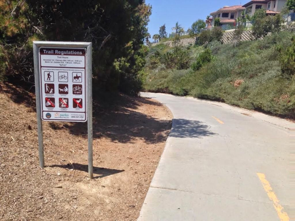 |
| Trail to Salt Creek Beach. The sign on the left features the “official” rules. |

 |
| Walk underneath the tunnel to the beach (make a left on your way out). |
 |
| Follow the trail along the golf course to the beach |
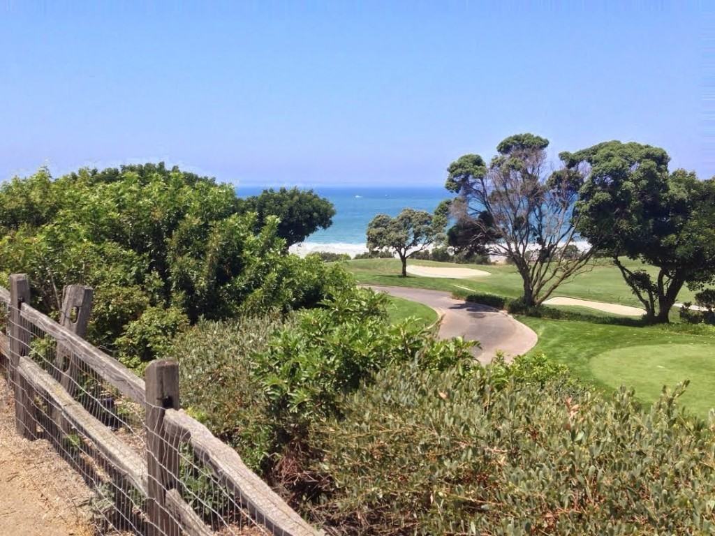 |
| Coastal and golf course views. |
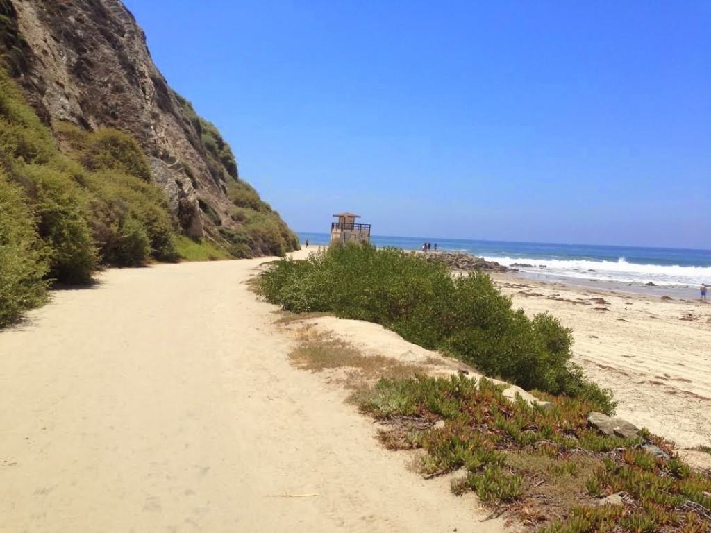 |
| Salt Creek State Park Beach |
- Barry-the-Bear: “This was a fun and easy hike! It was perfect for my beginner skill level. Make sure to follow the hiking trail through the tunnel the runs under Pacific Coast Highway. Don’t worry – it may feel like you are trespassing through the golf course, but you are not!”
- Larry-the-Lion: “Wow! This hike is great! I sound like Tony the Tiger, but I’m actually Larry the Lion cooling off at one of So Cal’s coolest beaches – Salt Creek!”
- Chris-the-Cheetah: “Easy BUT spectacular views! I enjoyed this ‘easy’ hike and kicked it up a notch by running Strands Beach, as well as Strands Bluff. It added 3 more miles this beach hike!”
Like to Hike? Connect with us on Facebook for additional hiking resources.
LEAVE a comment below and share a hiking experience with The Go Hike It community!